Skip to header Skip to main navigation Skip to main content Skip to footer

Search form

Home
Angel Fire New Mexico
Where Sunsets Catch Fire

Main navigation

  • Home
  • Dining
  • Lodging
  • Shopping
  • Skiing
  • Webcams
  • Things to Do
  • Outdoors
  • History
  • Business Directory

Article Archive

Winter Has Arrived in the High Country: When to Turn Around on Forest Roads
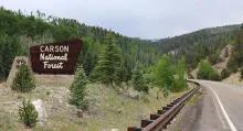
The Carson National Forest entrance sign beside New Mexico State Road 38 between Red River and Bobcat Pass, with forested slopes behind it.

Winter has quietly taken over the high country around Angel Fire, and the Forest Service is asking everyone who heads above the valley floor to plan like it. In alerts dated November 13, 2026, the Carson National Forest reported that recent storms have left high-elevation areas covered in snow and ice. That warning matters in the Moreno Valley, where a sunny start in town can give way to shaded ice, frozen ruts, and deep cold only a short climb into the national forest that surrounds the Enchanted Circle.
  • Read more about Winter Has Arrived in the High Country: When to Turn Around on Forest Roads

Forty-One Miles for a Trickle: The Big Ditch That Chased Elizabethtown's Gold

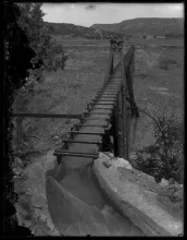
The elevated wooden flume that carried Red River water toward the Elizabethtown gold workings, photographed in the 1910s.

Did you know that some of the richest gold ground in the Moreno Valley nearly stayed in the dirt for want of water? When prospectors found placer gold in Willow Creek and the gulches on the west side of Baldy Mountain in 1866 and 1867, they found it in gravel that had to be washed to give up its color. The valley's own creeks were small and uncertain, and the hard winters shut work down for months. From the very first rush, the miners understood that Elizabethtown's future depended less on finding more gold than on bringing in more water.

  • Read more about Forty-One Miles for a Trickle: The Big Ditch That Chased Elizabethtown's Gold

Doc Westphall: The Historian Who Built America's First Vietnam Memorial

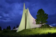
The white Peace and Brotherhood Chapel at Angel Fire spotlit at dusk on its grassy hillside above the Moreno Valley.

Everyone who drives U.S. Highway 64 above Angel Fire knows the white chapel on the hill, its curves sweeping fifty feet upward over the Moreno Valley. Fewer people know the man who raised it. Dr. Victor Westphall, known to generations of veterans simply as Doc, was a historian by training and a veteran himself long before he became a builder. He entered the United States Navy in 1943 as an ensign and served in the South Pacific during World War II, setting up message centers that kept front-line units in communication.

  • Read more about Doc Westphall: The Historian Who Built America's First Vietnam Memorial

Beneath the Valley Floor: How the Moreno Valley Filled With Stone

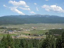
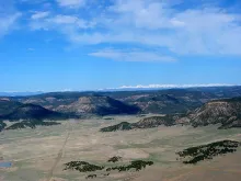
The town of Angel Fire on the flat Moreno Valley floor, with forested slopes and the Sangre de Cristo peaks behind it.

Stand in Angel Fire and look across the Moreno Valley, and the first thing you notice is how open it feels. The valley runs about twenty-seven miles from north to south and about five miles wide, with its floor at about eight thousand two hundred fifty-two feet. The Sangre de Cristo Mountains rise to the west and the Cimarron Range rises to the east, while Angel Fire and Eagle Nest sit on ground that looks calm and flat. That flat floor is not solid bedrock.

  • Read more about Beneath the Valley Floor: How the Moreno Valley Filled With Stone

Grazed Since 1848: The UU Bar Ranch and the W Bar That Was Taken

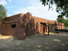
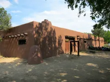
The adobe Kit Carson Museum at Rayado, on the UU Bar Ranch headquarters country where Lucien Maxwell first settled in 1848.

Did you know that cattle have grazed one Cimarron country ranch continuously since 1848? That is the claim at the heart of the UU Bar Ranch, established that year by Lucien B. Maxwell on land that was part of the 1,714,765-acre Maxwell Land Grant. The ranch abuts Cimarron and wraps around Philmont Scout Ranch on its south, east, and north sides, and its long life connects the Moreno Valley and Angel Fire country to the very first permanent settlement Maxwell planted east of the Sangre de Cristo Mountains.

  • Read more about Grazed Since 1848: The UU Bar Ranch and the W Bar That Was Taken

From Dirt Strip to Jet Runway: How Angel Fire Learned to Fly In

The Moreno Valley spreads below Angel Fire, the ranch valley that became a resort town with its own high mountain airport.

When Roy and George LeBus laid out their new resort in the Moreno Valley in the mid-1960s, they planned for more than ski trails. Alongside the first chairlifts, Monte Verde Lake, and a nine-hole golf course, they created a dirt airstrip on the ranch land north of the village. It was a practical idea for a remote cattle valley that was becoming a resort town: visitors who could fly in would not have to make the long mountain drive first. Federal records date the airport activation to September 1966, the same season Angel Fire Resort was born.

  • Read more about From Dirt Strip to Jet Runway: How Angel Fire Learned to Fly In

Bald Eagles in Late Fall: Winter Birds Gather at Eagle Nest Lake

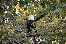
An adult bald eagle with a white head and yellow bill perched in a cottonwood tree.

Late fall brings a quiet change to the Moreno Valley, and one of its most welcome signs appears in the tall trees around Eagle Nest Lake. As northern lakes begin to freeze, bald eagles move south in search of open water and food, and their numbers around Eagle Nest Lake increase during December and January. For Angel Fire residents and visitors, the short drive to the lake on the Enchanted Circle offers one of the best chances of the year to see these large raptors close to home.

  • Read more about Bald Eagles in Late Fall: Winter Birds Gather at Eagle Nest Lake

Kit Carson at Rayado: The Scout Who Lent a Young Settlement Its Safety

The Kit Carson Museum at Rayado, a long adobe building with a bell at its gate, photographed in 2013.

Did you know that the first permanent settlement in Colfax County began not in a mountain valley, but out on the open plains east of the Sangre de Cristo Mountains? Lucien Maxwell founded Rayado in 1848, at the end of the Mexican-American War, where the mountain branch of the Santa Fe Trail met the Cimarron Trail. It was the first plains settlement in New Mexico east of the mountain valleys, and its name, Rayado, comes from the Spanish word for streaked, perhaps for the lot lines Maxwell marked out there.

  • Read more about Kit Carson at Rayado: The Scout Who Lent a Young Settlement Its Safety

The Red Chair: Lift 2 Has Carried Angel Fire Since 1966

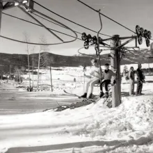
A historic black-and-white photograph of two skiers riding Lift 2, an original Riblet chairlift, at Angel Fire Resort in its early years.

When Angel Fire Resort opened in the winter of 1966, it rose on three Riblet chairlifts that George LeBus and general manager Jim Woods had built after walking the mountain and laying out the first trails in 1965. One of those original lifts is still part of the story nearly sixty years later. Lift 2, a fixed-grip two-seater, is fifty-nine years old, as old as the resort itself, and Angel Fire Resort describes it as a quiet witness to the growth of the ski area and to the generations of skiers and riders who have called these slopes home.

  • Read more about The Red Chair: Lift 2 Has Carried Angel Fire Since 1966

Three Days in January: How the Maxwell Grant Began on Paper in 1841

The Vermejo Park Ranch plains stretch west toward the snow-capped Sangre de Cristo Mountains on land that was once part of the Maxwell Land Grant.

Did you know that the Moreno Valley, where Angel Fire now stands, was once drawn inside a single land grant created by a petition and a governor's signature in just three days? The land was the ancestral home of the Jicarilla Apache, and Mexico, newly independent from Spain in 1821, continued the old Spanish policy of encouraging settlement by making large land grants. In the final years of Mexican rule, Governor Manuel Armijo made several such grants east of Taos, and none shaped these mountains more than the Maxwell Land Grant.

  • Read more about Three Days in January: How the Maxwell Grant Began on Paper in 1841

Pagination

  • Page 1
  • Next page ››

Angel Fire, NM Weather

Loading current conditions...

Loading forecast...

Upcoming Events

🎉 Angel Fire Resort Events Calendar

Coming Up:
Dec 10: Member and Passholder Preview Day — Angel Fire Resort
Dec 11: Opening Day — Angel Fire Resort
Dec 17: Stargazing and S'mores
Dec 20: Demo Days — Angel Fire Resort
Dec 24: Christmas Eve Torchlight Parade and Fireworks, 6 PM — Base Area
Dec 25: Skiing with Santa — Angel Fire Resort
Dec 31: New Year's Eve Torchlight Parade and Fireworks, 6 PM

Article Archive

Browse past articles

Copyright © 2026 Rocky Mountain Madman LLC - All rights reserved

Developed and Designed by Rocky Mountain Madman LLC