Winter has quietly taken over the high country around Angel Fire, and the Forest Service is asking everyone who heads above the valley floor to plan like it. In alerts dated November 13, 2026, the Carson National Forest reported that recent storms have left high-elevation areas covered in snow and ice. That warning matters in the Moreno Valley, where a sunny start in town can give way to shaded ice, frozen ruts, and deep cold only a short climb into the national forest that surrounds the Enchanted Circle.
Click to see more photos of the Carson National Forest
The road warnings behind that alert deserve a careful read. An earlier post-storm alert on October 30 said storms had degraded road conditions in parts of the forest, left soils oversaturated, and made washes dangerous to cross when water is running. The Forest Service also noted that Forest Road 87 at Apache Creek, elsewhere in the Carson, is impassable at a damaged culvert. The lesson for drivers near Angel Fire is that a forest road used to enter the backcountry may not be passable to exit, and conditions can change again quickly when more weather arrives.
Today in Angel Fire shows how fast the terms can shift. Friday began sunny and windy, with temperatures near 41 degrees feeling closer to 30 in west-southwest winds gusting to 45 miles per hour, and sunset comes at 4:49 in the afternoon. Clear skies tonight will let temperatures fall into the twenties and teens, freezing anything that melted during the day, and snow showers are in the forecast for Saturday. On an unplowed forest road, that freeze and thaw cycle is the real hazard: soft and muddy at midday, slick as glass by the time a driver is heading home in the dark.
Knowing when to turn around is the skill that matters most this month. The Forest Service advises travelers to avoid forest roads during and right after storms, to never drive through a flooded roadway, and to have a backup plan before leaving home. Share your plans with family or friends, carry extra supplies and warm layers, bring equipment for traveling in snow and know how to use it, and be prepared to be self-sufficient if you get stuck. Turning back at the first drift, ice sheet, or running wash is not a failed trip. It is the decision that keeps a pleasant drive from becoming a cold night in the forest.
The calendar adds one more reason for patience. Seasonal vehicle restrictions on many Carson National Forest roads take effect on January 1 and run through April 30 in most cases, protecting wintering and calving habitat for deer and elk as well as soil and watersheds. Here in the valley, winter recreation is about to shift to the paved highways and the ski slopes, with Angel Fire Resort scheduled to open on December 11. The forest roads will still be there in spring. For now, the high country is setting the terms, and the wisest drivers are the ones who listen.
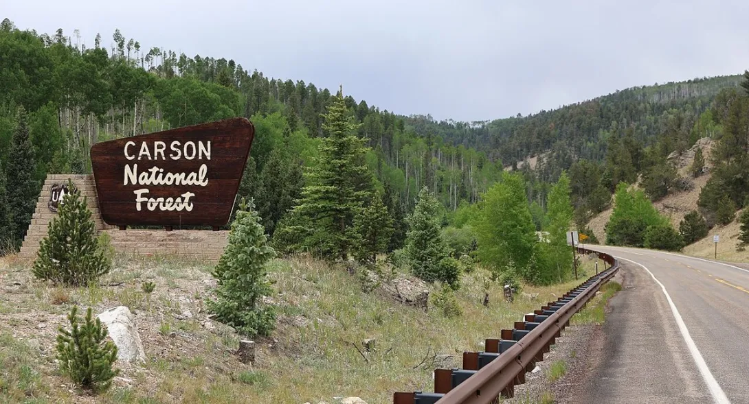
Photo: the Carson National Forest entrance sign on New Mexico State Road 38 between Red River and Bobcat Pass, by Jeffrey Beall, via Wikimedia Commons (CC BY 4.0).
Know before you go
Stay on designated routes only. Routes open to motor vehicles are designated on the Carson National Forest Motor Vehicle Use Map, and a road not shown on that map is not open to motor vehicles. Check current Forest Service alerts and closures before you go, because restrictions can change unexpectedly, and seasonal restrictions take effect on many roads on January 1. Practice Tread Lightly, respect gates and private land, and turn around rather than damaging a wet or snow-covered road.